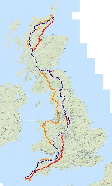
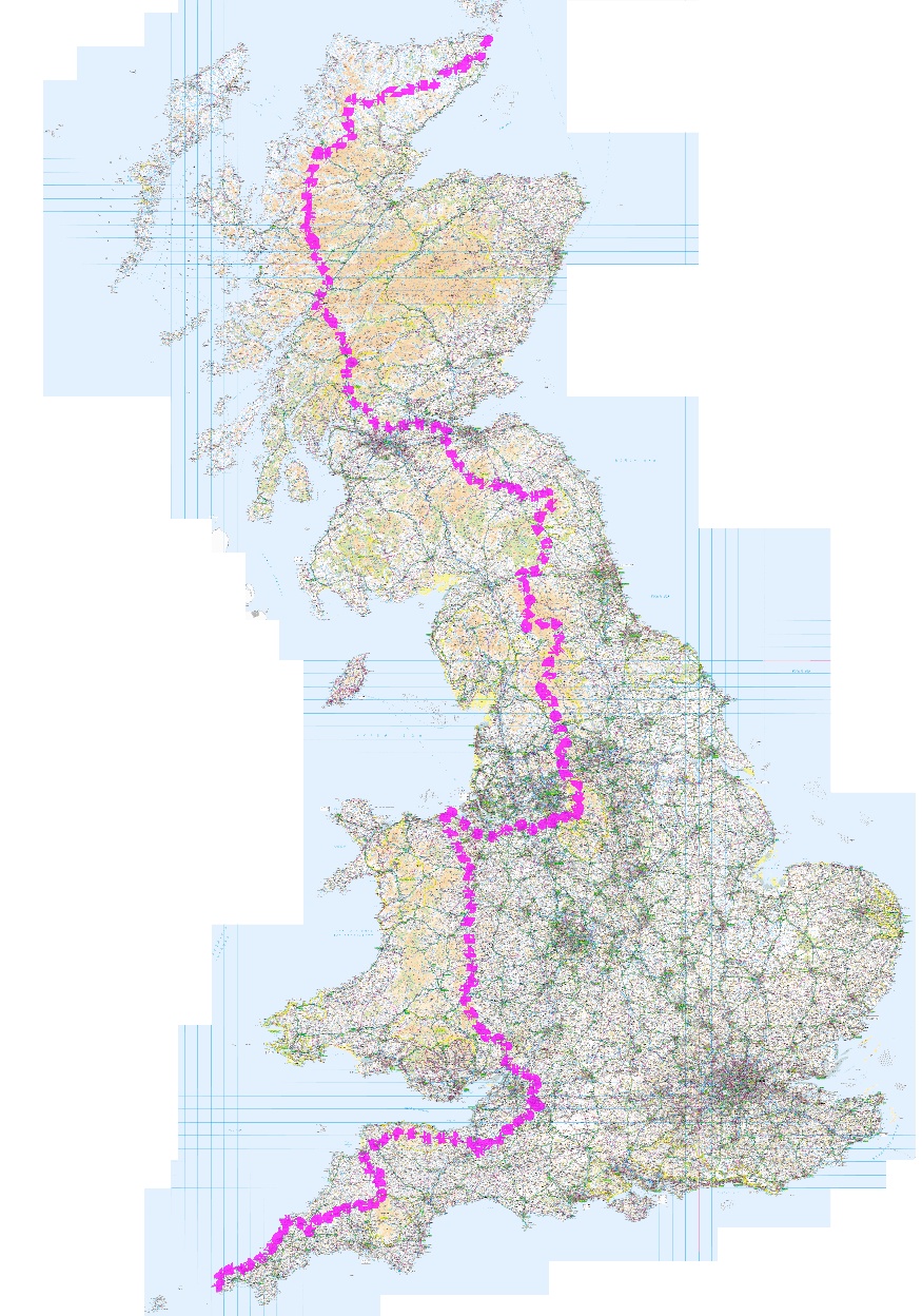
The northbound route (in pink) I have created (currently totalling 1,344 miles with a total ascent of 140,081 feet) starts at Lands End (no surprise there) and follows the SouthWest coast path until Padstow then heads inland on the Camel Trail and the Two Castles Trail to Oakhampton where I take the Tarka Trail north to Barnstaple.
The Macmillan Way West skirts the bottom of Exmoor to Bridgewater and onto the River Parrett Trail.
The Kennet and Avon Canal will take me to Bath where I'll join the Cotswold Way and Jubilee Way to the Severn Bridge.
The entire Offa's Dyke Path (177 miles) takes me to Prestatyn (a bit out of my way but I've always wanted to do the whole route).
The Wales Coast Path will then take me to Chester. I'll skirt around the south of Manchester across to Edale and the start of The Pennine Way (all 268 miles of it).
St Cuthbert's Way and the Southern Uplands Way lead to the Cross Borders Drove Road and then the Union Canal past the stunning Falkirk Wheel.
The John Muir Way leads onto the West Highland Way all the way to Fort William and the start of the Caledonian Canal and the Great Glen Way.
At the start of Loch Ness I turn north into the wilderness to cross the mountains for many miles with no long distance paths to follow.
The southbound route (in grey)(1,097 miles with "only" 82,033 feet of ascent) starts by using The John O'Groats Trail along the coast (which should make it easier to find food shops) and then The Great Glen Way along Loch Ness and The Caledonian Canal to Fort William.
From Glasgow I take The Clyde Walkway and The Annandale Way towards Carlisle.
The new King Charles III England Coast Path and The Cumbria Way get me to the top of The Lancaster Canal which I follow for its entire length.
I then follow canals for much of the journey down England. The Leeds and Liverpool, Trent and Mersey, Shropshire Union and River Severn take me to Gloucester and the Cotswold Way.
The Monarch's Way will take me to The Bridgwater and Taunton Canal and The Great Western Canal.
The Tarka Trail and Two Castles Trail get me to Bodmin Moor and The Camel Trail.
I return to Land's End via The Southwest Coast Path for a well earned rest!
By using long distance paths and National Trails I am hopeful that most of the route will be reasonably well marked and well walked. That should mean less fighting my way through brambles and blocked footpaths!
To view any of the GPX files, copy them to your PC or phone and then drag them to www.viewgpx.com
Download my routes here...